Map of the Holy Land
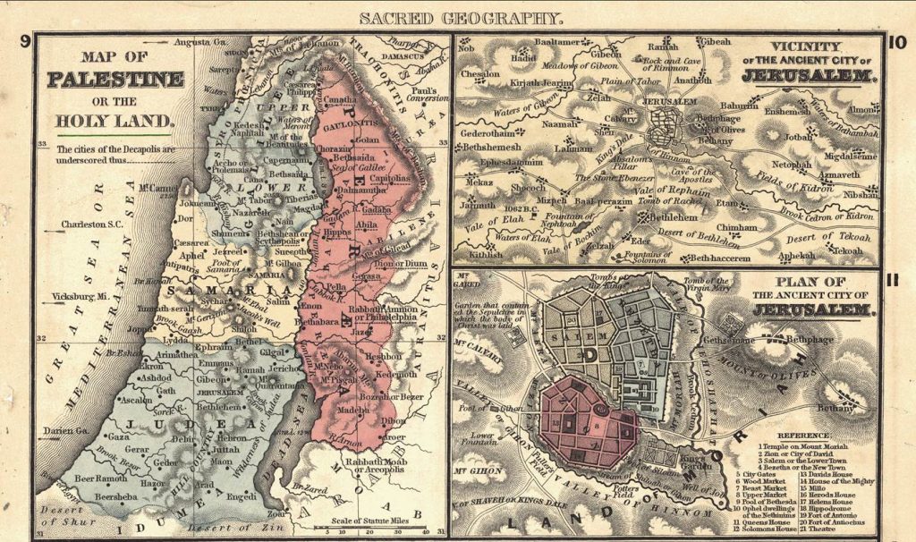
In spirit of the season, this month’s featured map is a detail of “the Holy Land”, mapped by Samuel Augustus Mitchell in 1864. Mitchell was an American geographer, born in Connecticut, who worked as a teacher and started producing maps after being dissatisfied with the maps in his students’ textbooks. His company “The Mitchell Company” was one of the leading map publishers in North America in the mid-19th century.
The detail of the map “Map of Palestine, Vicinity of the Ancient City of Jerusalem, Plan of the Ancient City of Jerusalem, Map of the Incursions of the Barbarians” featured here, shows an overview of the Holy Land as well as two more detailed maps of Jerusalem, Bethlehem and surroundings (top right) and a city map of Jerusalem (bottom right). Interesting to note is also the reference to American cities on the left side of the map, giving the American map reader an indication of how far south the Holy Land is located.
The Map Library wishes all its visitors a Merry Christmas and a Happy New Year!